Feedback to the planning applications has been received from local councils, the community, stakeholders and other interested parties.
We have reviewed all feedback and, where appropriate, have made changes that respond the points made. Click on the points of our interactive map below to find out more.
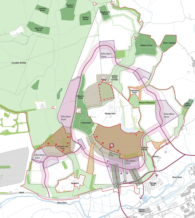
Sustainable movement
The main 'boulevard' access to Village 1 is to be made a sustainable transport only corridor with dedicated provision for buses, walking and cycling. We are also working with Essex County Council to help deliver new sustainable transport infrastructure and replace the existing River Way road bridge.
Sustainable movement
A new access point for all modes of transport including private vehicles will be created to the east of the boulevard access.
Sustainable movement
The design of the junction providing access into Gilston/Pye Corner will change significantly to reduce impact on homes in and around Terlings Park. The junction is reduced in size and moved to the north to provide room for noise mitigation to Terlings Park. Access to Terlings Park is to be moved to the west via Burnt Mill Lane and the existing alignment of Eastwick Road.
Inclusive growth
Increased employment floorspace to meet the demand for future workspace and job opportunities.
Natural and historic landscape
Village buffers have been increased in a number of areas, including to the south of Channocks Farm (to 30m) and to the north (to 20m)
Natural and historic landscape
Village buffers have been increased in a number of areas, including to the north of Pye Corner (to 30m)
Natural and historic landscape
Village buffers have been increased in a number of areas, including between Village 1 and Village 5 to give more space between these two villages
Natural and historic landscape
We also propose to extend sensitive development areas in response to discussions with Historic England.
Natural and historic landscape
We also propose to extend sensitive development areas in response to discussions with Historic England.
Natural and historic landscape
We have also removed an area proposed for development on land to the south of St Mary`s Church.
Natural and historic landscape
We have also allowed more flexibility within the new villages for the 'sustainable transport corridor', which will be the main route for cycle and bus travel. Also, in response to feedback about new development near the Eastwick moated sites and the Mount, we have reduced the amount of flexibility for the route so that we protect these heritage features.